Second in a Series; Preserving the Past to Serve the Future
The idea of Slow Technology or “Slow Tech” has its roots in the ideological movement called “appropriate technology,” a term coined by E.F. Schumacher in his book Small is Beautiful, first published in 1973. Slow Tech should be thoughtful about how devices shape our relationships to time, emotion, energy, and bioregional environment.
Transition fosters and supports the revitalization of Slow Tech skills and asks us to relearn the proficiency needed to reanimate the skills need to build and navigate sailing vessels and canal boats while reinvigorating our bioregional water highways for a post carbon future.
The Hudson River and the New York Harbor once formed a bustling highway linking even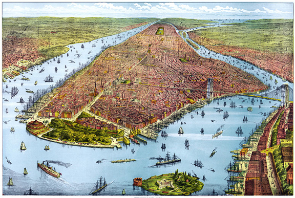 the smallest communities to a web of regularly scheduled commercial routes. Schooners, sloops, barges, and steamboats provided a unique way of life for early river town inhabitants. Farmers, merchants, and oystermen relied on this vibrant and diverse fleet of vessels to bring in supplies and deliver their goods to market. The sea was an integral part of the lives of those who worked the
 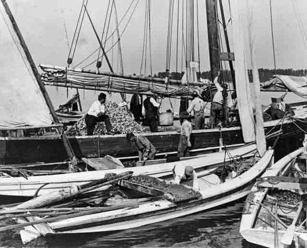 inland waters of New York City Bioregion.
With one of the world’s greatest ice-free harbors on earth, New York City was built on a shipping industry that has over time become a dangerously tenuous lifeline to the outside world for the bioregion. Today the far-flung international trade network that once pumped vibrant economic life into the region threatens to collapse as imported natural resources and the fossil fuels needed to transport them become increasingly scarce and expensive. Higher petroleum costs, and higher wages in countries in which much of our imported goods are made could snap that lifeline.
The solution may be a return to the “Slow Technology” of our recent past — sail powered 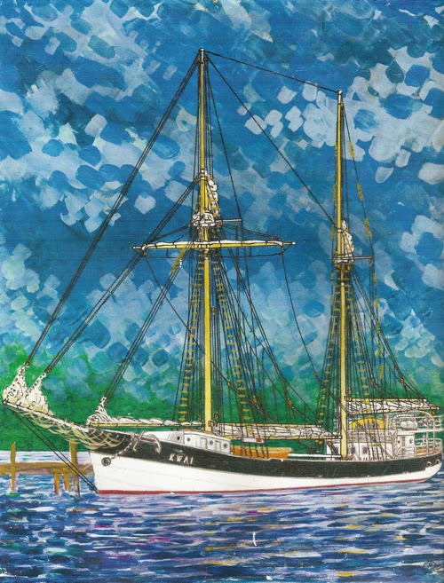 freight ships or invoke the future of solar powered ferries and barges. According to Low Tech Magazine, wind powered freighters may be just as fast as the largest most “modern” container ships, and recently a vessel powered entirely by the sun circumnavigated the globe. “Tomorrow,” New York City will likely to continue to be a commercial hub due to its strategic location, but it’s harbor will likely resemble its 18th and 19th century self rather than the port we know today.
What existing and potential waterways could be reinvigorated to move cargo and people between ports on the Hudson River, the Long Island Sound, and New Jersey, New York, and Connecticut’s coastal waters using the Slow/Appropriate Technology of sailing or hybrid freight vessels?
The Web of Navigable Rivers, Bays, and Sounds of our Bioregion:
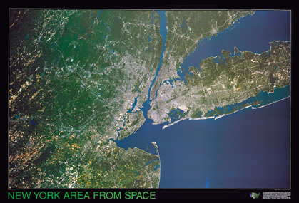
When viewed as a geographic entity, the Mid-Atlantic Bioregion is an intricate web of Rivers, Bays, Sounds, and canals. Up until the mid- 20th Century, these waterways worked seamlessly as water highways connecting hubs of commerce and farming with small ports and large cities. In a post carbon future Slow Tech vessels, built by re-skilled artisans, and crewed by re-skilled seafarers will repair that link.
The Hudson is the largest river in the region but other rivers, bays and sounds are navigable and appropriate for sailing and hybrid Slow Tech vessels. These include Barnegat Bay, Raritan and Newark Bays in NJ. The Upper and Lower New York Bays are connected to Newark and Raritan Bays by The Arthur Kill and The Kill Van Kull tidal straits.
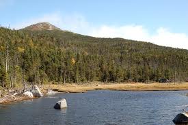 The Hudson River rises in the mountains at Lake Tear of the Clouds in Essex County, NY and empties into Upper New York Bay. The Hudson is a drowned river as its bottom is below sea level almost all the way to Albany. The Hudson is also considered a fjord one of very few in North America. The River was a commerce highway for as long as
 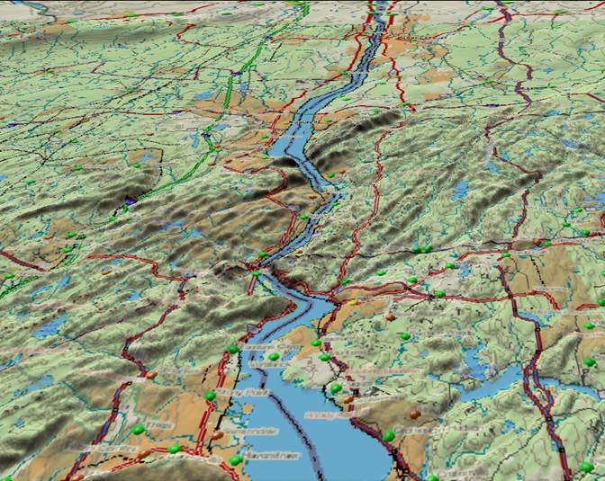 humans have inhabited the North American continent. Henry Hudson and other early European explorers were convinced that the River was part of the Northwest Passage.
The Raritan River in New Jersey is navigable to New Brunswick where the entrance to the Delaware and Raritan Canal begins. The Passaic River is navigable from Newark Bay to two and a half miles downstream of the Dundee Dam at the Eighth Street/Locust Ave Bridge in Wallington, NJ. The Hackensack River is navigable to the City of Hackensack. Newark Bay is the location of the large container ports and has historically been a center of maritime commerce.
The East and Harlem Rivers are straits that connect the Harbor to Long Island Sound. The Connecticut River is also navigable as are other tributaries to the Sound. Long Island Sound is a large estuary separating Long Island from Connecticut. There are small ports on each of these navigable waters that are of an appropriate scale for the type of vessels required for post carbon “short sea” transportation.
Canals past present and future:
There are also “manmade” waterways still in use such as the Eire and Champlain Canals, as well as historical but now abandoned canals like the Delaware and Raritan Canal, and the Morris Canal both in New Jersey that could be converted back to use, connecting The 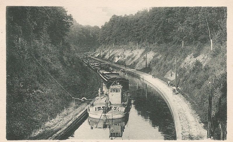 Hudson and Raritan Rivers to interior New Jersey and to Philadelphia by way of the Delaware River
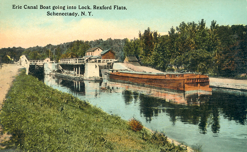
During the early nineteenth century, when the United States was becoming and industrial power, canals were built as transportation routes to link resources, manufacturing centers and markets.There were roads but hauling freight by horse or oxen and wagon was expensive and slow. Continued growth demanded a more viable means of transporting goods. Canals seemed to be the answer. Two mules could pull a canal boat with a twenty-five ton cargo.
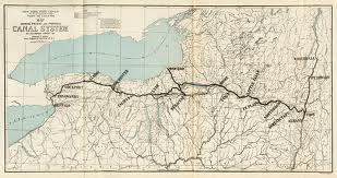 The Eire Canal begins on the west side of the Hudson River at Albany. It runs just east of the Niagara River, where it reaches its Western Terminus. With the recent re-watering of the Commercial Slip, a water route from the eastern terminus at Albany to the western terminus at Buffalo is once again open and being used by commercial and recreational vessels.
The canal system gave New York State a competitive advantage, helped New York City  develop as an international trade center, and allowed Buffalo to grow from just 200 settlers in 1820 to more than 18,000 people by 1840. The port of New York became essentially the Atlantic homeport for all of the Midwest.
The Champlain Canal one of America’s first canals, opened up vital shipping routes along the Hudson River in upstate New York. The Champlain Canal’s impact was substantial, opening up shipping lanes from New York north to Lake Champlain and on to the St. Lawrence Seaway, spanning from Waterford to Whitehall.
The Delaware and Raritan (D&R) Canal connects Bordentown on the Delaware 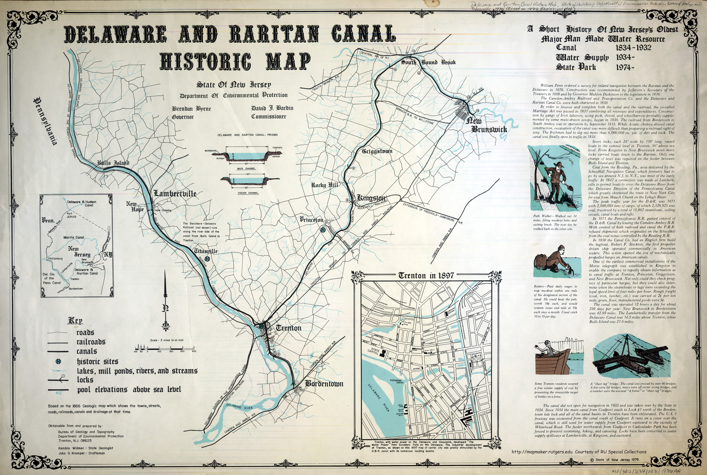 River to New Brunswick on the Raritan River in central New Jersey. The canal was built in the 1830’s and connected the Delaware River to the Raritan River. It was intended as an alternate means of transportation of freight between Philadelphia, PA and New York City, especially coal from the anthracite coal fields in eastern Pennsylvania. Before the railroads, the canal allowed shippers to cut miles off the route from the Pennsylvania coalfields, down the Delaware, around Cape May, and up along the Atlantic Ocean coast to New York City.
The Morris Canal left the Delaware River at Phillipsburg and across the mountains of  northern New Jersey. Locks were used to overcome small changes in elevations. Inclined planes overcame changes in elevation greater than twenty feet. The canal went across lakes and rivers, until it reached the Lake Hopatcong area, its summit level. From there it climbed down to the tide level at Newark.
Today, these water highways still exist and need to be reinvigorated. Maintaining maritime trade routes is more than just a celebration of tradition. In a carbon constrained future sustainable water transport will be necessary and in the event of a regional disaster water-based community links can serve 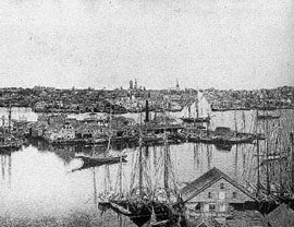 as vital infrastructure.
Waterways Information List
- The Hudson – https://en.wikipedia.org/wiki/Hudson_River
- Barnegat Bay – https://en.wikipedia.org/wiki/Barnegat_Bay,
- Raritan Bay – https://en.wikipedia.org/wiki/Raritan_Bay,
- Raritan River https://en.wikipedia.org/wiki/Raritan_River
- The Passaic River – https://en.wikipedia.org/wiki/Passaic_River
- The Hackensack River – https://en.wikipedia.org/wiki/Hackensack_ River
- The East River- https://en.wikipedia.org/wiki/East_River
- Harlem River – https://en.wikipedia.org/wiki/Harlem_River
- Long Island Sound – https://en.wikipedia.org/wiki/Long_Island_Sound.
- Newark Bay – https://en.wikipedia.org/wiki/Raritan_Bay Bays in NJ,
- Upper and Lower New York Bay – https://en.wikipedia.org/wiki/Lower_New_York_Bay
- New York Bays are connected to Newark and Raritan Bays by
- The Arthur Kill https://en.wikipedia.org/wiki/Arthur_Kill and
- The Kill Van Kull https://en.wikipedia.org/wiki/Kill_Van_Kull tidal straits
- The East River https://en.wikipedia.org/wiki/East_River and
- Harlem River https://en.wikipedia.org/wiki/Harlem_River
- Long Island Sound https://en.wikipedia.org/wiki/Long_Island_Sound.
- The Eire Canal https://www.nycanals.com/Erie_Canal
- The Champlain Canal https://www.champlaincanal.org/,
- The Delaware and Raritan (D&R) Canal https://www.dandrcanal.com/history.html
- The Morris Canal https://canalsocietynj.org/CSNJ/
beautiful, thank you so much! Road trip along what remains of the D&R and Morris canals, anyone?
One tug captain moving oil from NYHarbor to Philly mused on how, instead of a short, direct cut across of about 150 miles, he has to take his barge out to sea, along the Jersey shore, up the Delaware Bay, and up the river for about 275 miles. But then, that would be one major portage, a fully loaded oil tanker…